Saturday, October 26, 2019
Trailhead: Valley Way trailhead, over to Crawford Notch and Webster-Jackson trailhead
Miles: ~22 miles
Elevation Gain: ~8800′
GaiaGPS track (partial route due to battery dying)
GaiaGPS route
After fitful sleep due to loud people laughing into the night in the next bunkroom over and being literally poked awake by one of my bunkmates as he arrived at midnight because he apparently “couldn’t sleep with that thing on” – that thing being a white noise maker on my phone. I wasn’t in a pleasant mood after that exchange, but I was up at 5am and out of the hostel by 5:15am, and on trail by 5:30am, though I had to take a quick stop to dig myself a hole before I hit the trail in all earnestness at 5:45am. I hiked up Valley Way until the trail intersection with Watson Path.
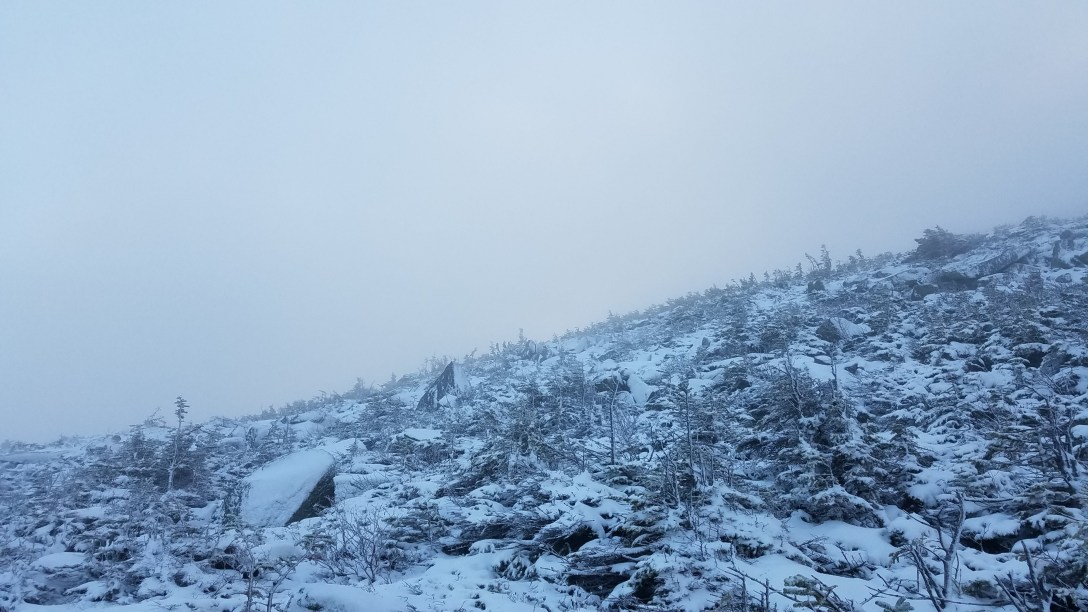
I decided that I’d just take Watson Path up to Mt Madison, since it was shorter than going up Valley Way to the hut and then going up and down Mt Madison. I hadn’t accounted for how much more time I’d spend above treeline on Watson Path compared with Valley Way. The wind picked up snow to create poor visibility; additionally, the snow was more significant than even the Mt Washington observatory had forecast, with 3-4 inches of snow on most surfaces. With windchill, it was 5-10 degrees for the majority of the morning. I made it to the summit of Mt Madison, and then carefully headed my way down to the hut, nearly breaking my ankles as I kept sliding in between gaps in the rocks that I couldn’t see due to the snow fall.
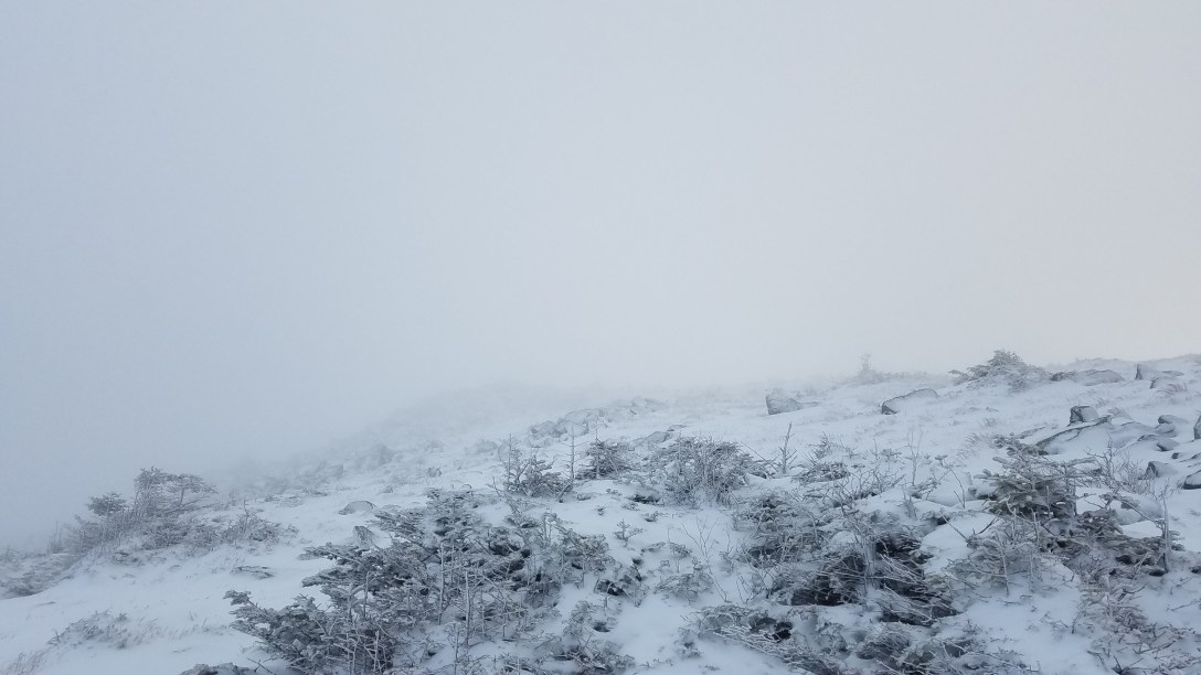

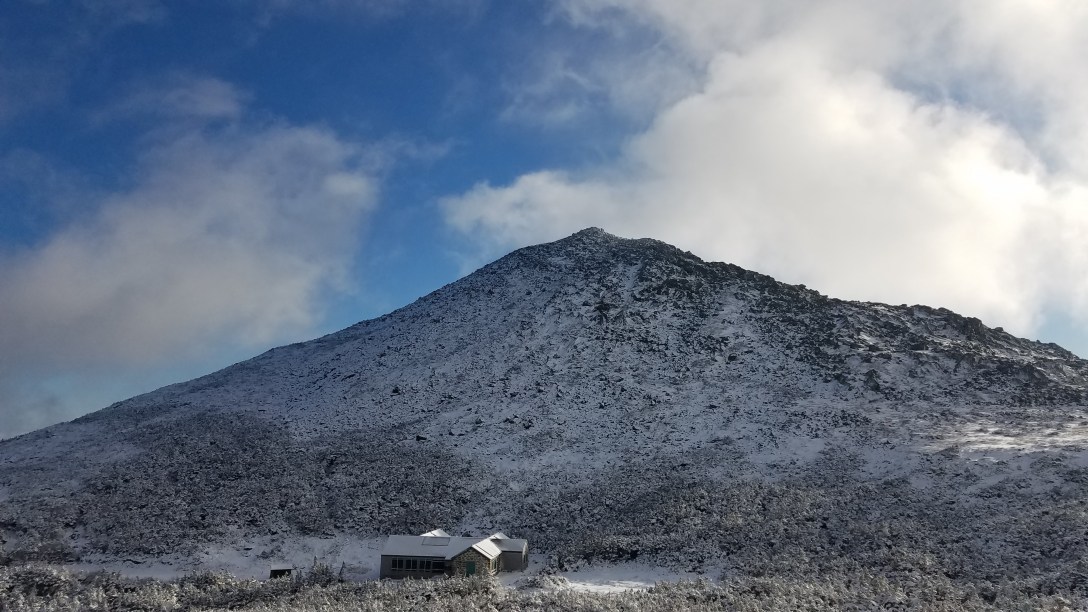
Mt Madison and Madison Hut
I followed Gulfside Trail to Airline Trail to the summit of Adams and then followed Lowe’s Path/AT along the ridge, over Adams Five and to Edmands Col, where I took the right to do the Jefferson loop. I had been checking my GPS to figure out which turns I needed to make, and found that the cold had sapped my battery and I’d managed to leave my battery brick in the car. So I killed my GPS tracker and turned off my phone, to save the 5% battery in case something happened, and to text my shuttle once I knew my ETA.
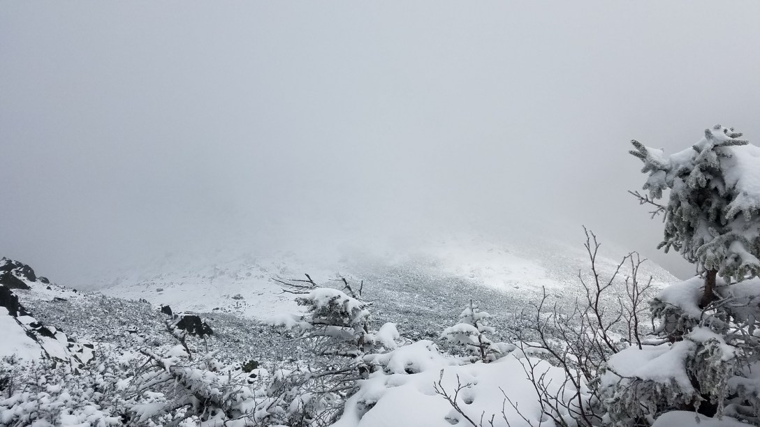
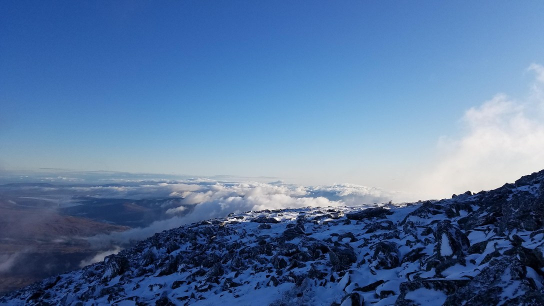
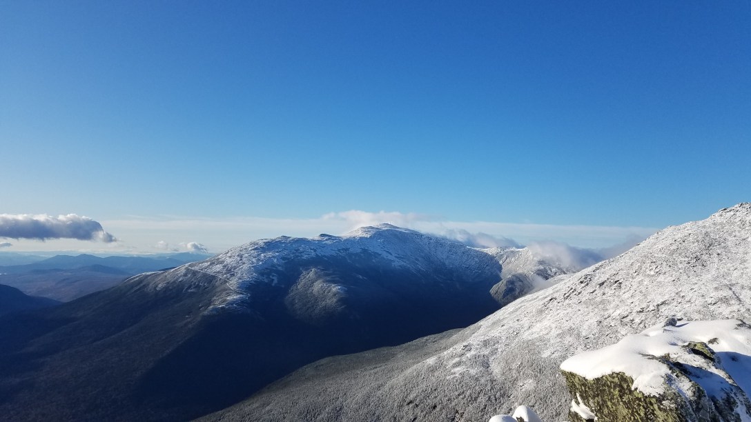
Once I got back to the AT after summiting Jefferson, I stayed on that trail to the summit of Washington and beyond. Between the climb up Adams and Mt Washington, the wind and visibility were terrible and I was traveling cairn to cairn. I encountered snow up to my knees. I passed by a solo hiker on his way up Adams, and then crossed paths with a group of 4 young people with small school/LL Bean-style backpacks heading towards Adams. I didn’t see people again until I was within 2 miles of Mt Washington, where I saw ~8 people heading down from the summit, including one person in cotton sweatpants. I made the Mt Washington summit without a soul in sight; I didn’t see people within 30 minutes of either side. I took a quick selfie with my iPhone I use to listen to audio books and then scrambled down towards Lake of the Clouds.
As I descended, the wind started to calm and the clouds slowly started to burn off. At the summit of Monroe, there started to be some blue sky visible, and by the summit of Eisenhower, there were only clouds around Mt Washington and the temperature was solidly in the 30s; I had to remove a number of layers, since I was starting to overheat. I had more snacks, treated some water I’d collected at Lake of the Clouds, and then headed out. After summiting Pierce, I decided to go for Jackson. I made the summit by 6:30pm, maybe 15 minutes after sundown, and used my phone’s remaining 3% battery to send out a text to my shuttle before it died. I scurried downward by headlamp, arriving at the trailhead by 7:45pm.
Unfortunately, there was a misunderstanding between the person I texted and my shuttle driver, so I wasn’t picked up until 8:30pm, despite them arriving in the area by 7:45pm. The shuttle driver dropped me off at my car and we headed back to the hostel, arriving around 9:30pm.
After the long day and tomorrow’s freezing rain, I decided to not hike tomorrow and instead, meander my way home.
