Sunday, Dec 22, 2019
Start/End: The Cog Railway
Mileage: 8.5
Elevation gain/loss: 3908′
GaiaGPS track
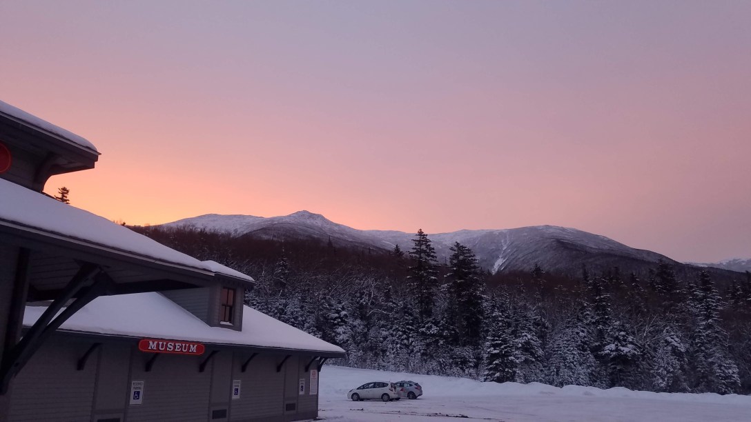
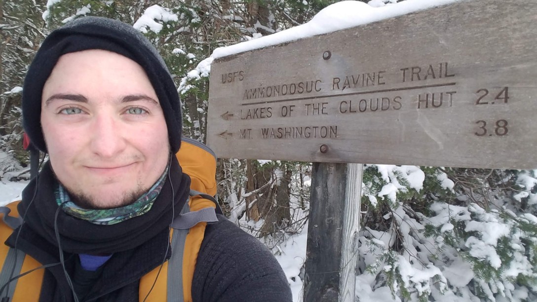
After sleeping in my car in the Gorham Walmart parking lot, I headed to Dunkin Donuts at 5:45am to change and fuel up for my day of hiking. They were kind enough to fill up my Nalgene and Thermos with near-to-boiling hot water for my hiking tea. I decided to try out one of my favorite teas (Harney & Sons decaf Hot Cinnamon) for today’s hike, and it was a good choice; it was the perfect blend of sweet and warming, without needing anything added. At 6:20am, after a coffee and a breakfast sandwich, I drove the 45 minutes to the Cog Railway base station. I paid the $10 at the station and used the bathroom, and then suited up. I was on trail by 7:40am, heading up the Ammonoosuc Ravine Trail towards Monroe. Right after I started walking, I realized that one of my Hillsound microspikes had torn a chain out of the rubber ring, so I used some zip ties to temporarily fix it; they worked like a charm.
After the first 30 minutes or so, I caught up to the group that had left the parking lot 10 minutes before me. It was a group of maybe 10-12 people, and they’d stopped right by Gem Pool, pretty much parking themselves in the middle of the trail. I went to go around and started down the wrong trail; some older man yelled after me and I redirected back to the correct trail, which required just about stepping on two people in their group. They were a group that was wearing heavy jackets, completely full 60+ liter packs, mountaineering boots, and were putting on their crampons. They were more of the ‘slow, steady, prepare for every possible outcome’ kind of folks. At the same time, I was carrying a partially full 55 liter bag with snowshoes strapped to the back, wearing microspikes, so I wasn’t exactly carrying nothing (unlike the solo hiker I saw going up towards the summit with a 5 liter backpack, no snowshoes, and a bottle of Polar seltzer). I made it all the way to the summit of Washington and two-thirds of the way back to the hut before I saw them again, slowly working their way towards the summit in full crampons.
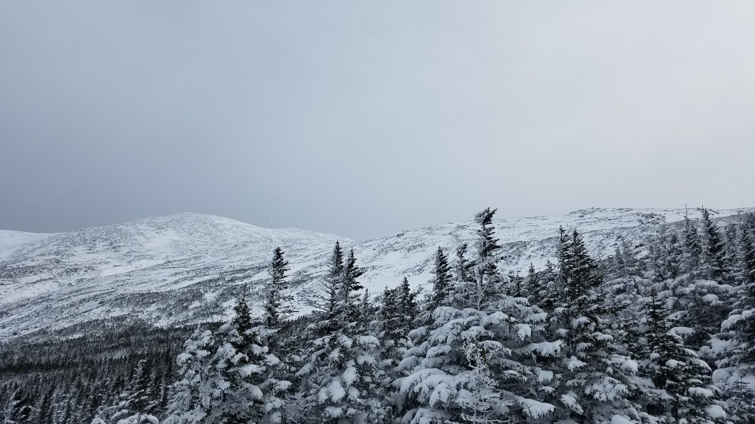
I passed by the group and headed up into the steeper section of the trail. I made good time and felt good about my footing while wearing my spikes. I made it to the Lake of the Clouds hut in less than 2 hours; I took a quick break (should have taken more time to eat more snacks) and then headed up towards Washington, figuring I’d do Monroe on my way back, since the meteorologists on Washington said the 45-60 MPH winds were supposed to increase steadily throughout the day, topping out in the evening with gusts of up to 90 MPH.
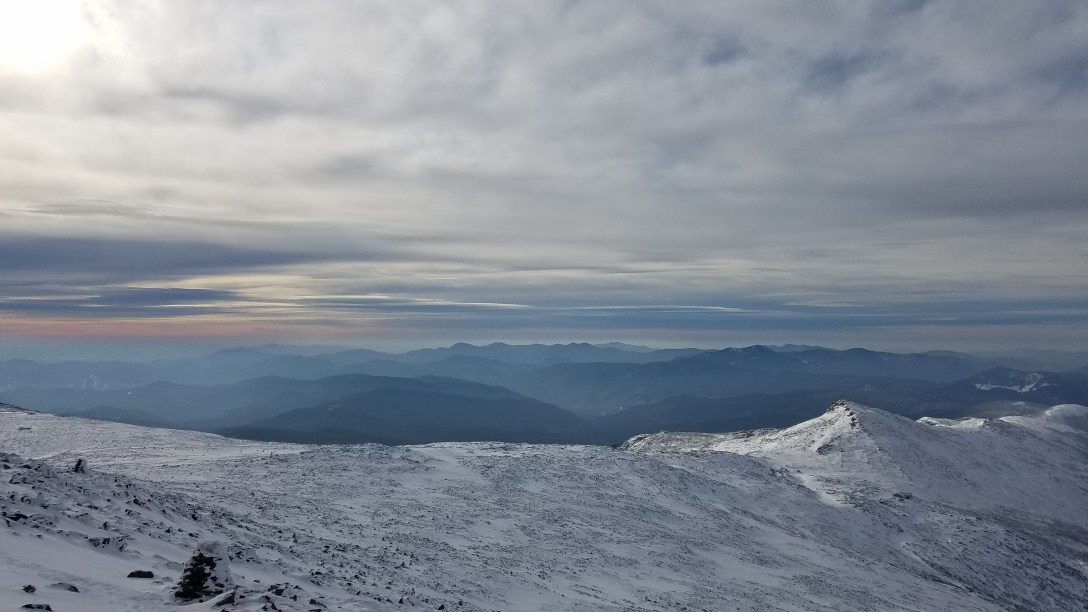
As I made the 1.5 mile trek to the summit from the hut, the wind started battering me and my leg muscles started failing. My left thigh muscle began cramping every time I straightened my leg, and my right calf and hip started cramping intermittently as well. I pushed through it and made it to the summit. I found an ice climber/mountaineer at the summit who had come up the Lions Head summer route; we swapped picture taking for each other at the summit sign before scurrying back out of the wind.

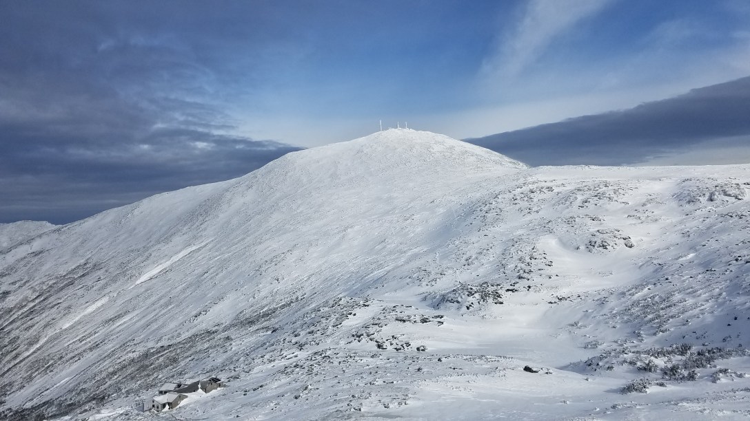
I quickly made my way back down to the hut, dropped my backpack, and headed up Monroe. I took a few pictures and then hiked back down to the hut, where I took a good long 20 minute break, drinking tea and eating homemade trail mix. Then I headed back down the way I’d come, half hiking/half skiing my way back down to the parking lot.

Door to door time was 5.5 hours, with 4.5 hours moving time. When moving, I averaged 1.9 MPH; overall, I averaged 1.5 MPH. It was an absolutely beautiful way to start off the winter hiking season!

Curious why you didn’t park at Ammonusuc/Jewell Trailhead and save $10?
LikeLike
I considered it and decided that I would like this trailhead to remain open; the Cog railway plows the road and without them doing that, the trailhead would not be accessible. $10 seems a reasonable fee for that access.
LikeLike